Subhead
Feedback period on proposed flood maps extended to April 30.
-

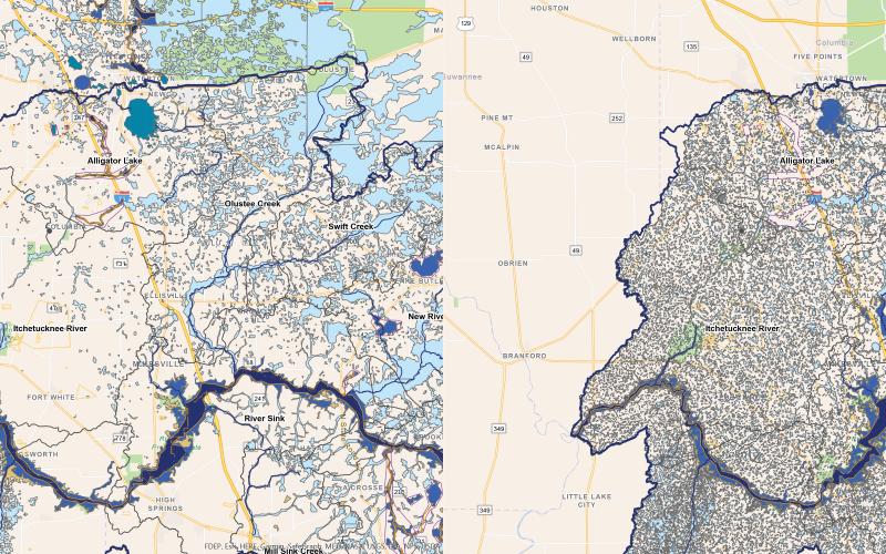
LEFT: The current FEMA flood risk map for the Santa Fe Watershed, which shows areas in light blue and dark blue that are in flood zones. RIGHT: The draft preliminary FEMA flood risk map for the Santa Fe Watershed, which is inundated with flood zones throughout the lower half of Columbia County. Comments on the maps is accepted through April 30. (COURTESY GRAPHICS)
The message was delivered clearly and continuously Monday at a Columbia County Commission workshop: flood the system with comments and concerns over FEMA’s new draft flood risk maps.
From county…
Premium Content is available to subscribers only. Please login here to access content or go here to purchase a subscription.