
Christmas is bringing something different to North Florida this year: “dangerously cold” weather through Monday, according to the National Weather Service.
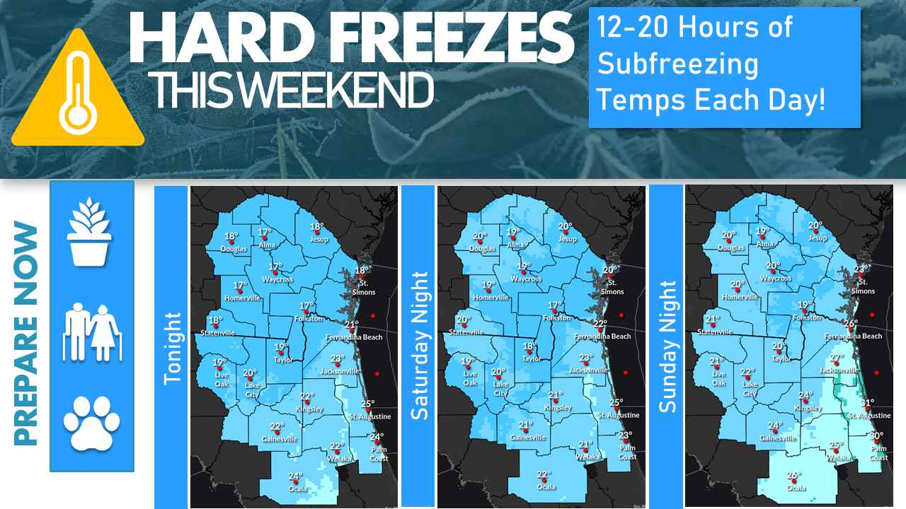
In a Friday release, the NWS said the very cold air mass is funneling through the area tonight and will linger in the area through Monday night, accompanied by hard freeze warnings and wind chill advisories for tonight. The two coldest consecutive days of the year are expected to be Saturday and Sunday.
The Friday afternoon forecast calls for temperatures into the 20s by midnight with 10-15 mph winds with gusts of 15-25 mph. As the temperatures fall into the teens to low 20s by sunrise Saturday, the wind chills will hit 5-15 degrees. That will be the coldest wind chill for the area since the 1980s.
On Christmas Eve, the high temperatures will only get into the mid-30s to mid-40s, according to the NWS forecast with wind chills in the 20s. Another long, hard freeze is expected Saturday night.
Christmas Day will include temperatures in the 40s followed by another hard freeze Sunday night.
Temperatures wills tart to warm Monday and Tuesday with highs nearing 60 by Tuesday, although a hard freeze is likely Monday night for parts of the Suwannee River Valley.